Top Five Hiking Trails in the Pacific Northwest
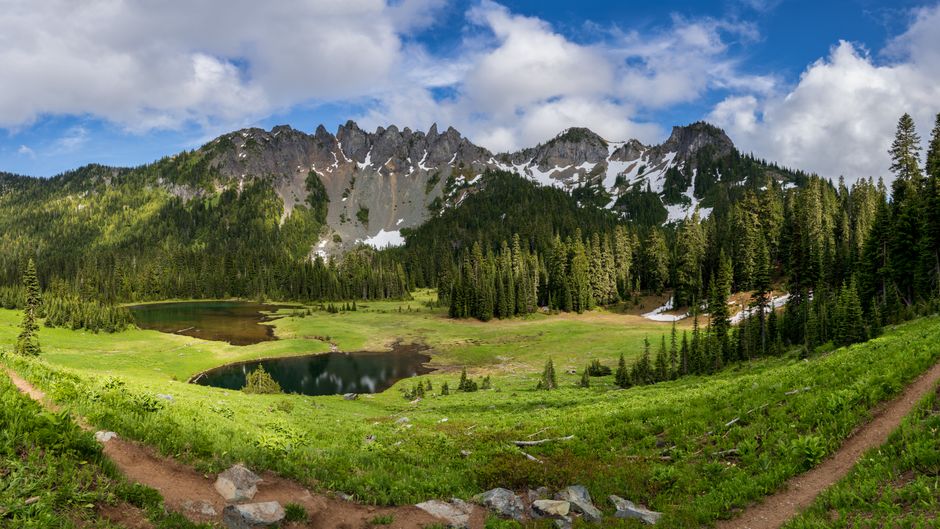
The Pacific Northwest is known for its dramatic landscapes, from rugged coastlines to towering volcanic peaks. Among these natural treasures, alpine lakes hold a special appeal for hikers seeking cool waters and reflective vistas. The region offers a wide range of trails that vary in length, elevation gain, and technical difficulty, making it possible to find a suitable route for many different experience levels.
Each trail in this selection was chosen because it showcases a distinct aspect of the Pacific Northwest’s mountain environment. Some paths wander through old-growth forests before reaching open meadows, while others ascend steep ridges to reveal multiple lake-filled basins. The following five trails provide access to alpine lakes that reflect the surrounding peaks and offer opportunities for rest and observation.
Before setting out, it is useful to check current trail conditions, weather forecasts, and any permit requirements. Conditions in the mountains can change quickly, and preparation contributes to a safer and more enjoyable experience. The descriptions below focus on each trail’s terrain, notable features, and what hikers might expect along the way.
Snow Lake Trail, Snoqualmie Pass, Washington
The Snow Lake Trail is one of the most frequented routes in the central Cascades, largely because of its relatively moderate distance and the striking lake at its terminus. The trail begins at the Alpental parking area and follows a well-maintained path through mixed conifer forest. After roughly one mile, the forest opens into subalpine meadows that burst with wildflowers during the summer months.
As the trail climbs gradually, views of surrounding peaks such as Chair Peak and The Tooth become visible. The final approach descends slightly to the shore of Snow Lake, a large body of water set in a glacial cirque. The water is clear and cold, reflecting the steep granite walls that enclose it. Many hikers choose to spend time exploring the shoreline or simply sitting by the water before heading back.
The round trip distance is approximately seven miles with an elevation gain of about 1,200 feet, making it a suitable option for those who are comfortable with a half-day hike. The trail is typically free of snow from July through October, though lingering snowbanks can appear earlier in the season. As with many popular destinations, arriving early helps with parking availability.
Lake Ann Trail, North Cascades National Park, Washington
Lake Ann is situated in the heart of the North Cascades, an area known for its jagged peaks and dense forests. The trailhead is located along the North Cascades Highway near the town of Mazama. The route follows the Lake Ann Trail through a series of switchbacks that ascend through hemlock and fir stands before opening into alpine terrain.
The trail offers intermittent views of the surrounding mountains, including the prominent spire of Liberty Bell Mountain. After climbing steadily for approximately two miles, the path levels out and reaches the lake. Lake Ann sits in a rocky basin beneath the imposing face of Cutthroat Peak. The water has a deep turquoise hue, especially on clear days when sunlight penetrates the surface.
The round trip is about six miles with 1,800 feet of elevation gain. This trail is considered moderately strenuous, and hikers should be prepared for uneven footing in some sections. The area is managed as part of the national park, so pets are not permitted on this trail. The best time to visit is between early July and late September, when snow has mostly melted.
Heather-Maple Pass Loop, North Cascades, Washington
The Heather-Maple Pass Loop is a classic hike that combines two distinct passes and multiple alpine lakes. The loop can be started from the Rainy Pass parking area, and it is frequently done in a clockwise direction. The first portion of the trail climbs gradually through meadows dotted with heather and low shrubs.
As elevation increases, the views expand to include the jagged ridges of the Sawtooth Range. The trail reaches Heather Pass at about six thousand feet, then continues along a ridgeline that offers panoramic vistas in all directions. From the high point at Maple Pass, hikers can look down into steep valleys where small lakes and tarns catch the light.
Descending from Maple Pass, the trail passes several lakes including Lake Ann (a different body of water than the one previously described) and the aptly named “Heather Lake.” The entire loop is approximately seven miles with 2,000 feet of elevation gain and loss. The route requires solid footing on exposed sections, and wind can be strong along the ridges. Late summer is the recommended time for this hike, as wildflowers are plentiful and the weather tends to be more stable.
Blue Lake Trail, North Cascades, Washington
Blue Lake is accessed via a relatively short but steep trail that begins at the Blue Lake Trailhead off the North Cascades Highway. The climb is steady from the start, gaining elevation through a forest of subalpine fir and mountain hemlock. The trail surface is composed of dirt and rocks, with some sections of exposed bedrock.
After about two miles of ascent, the trees thin and the lake becomes visible. Blue Lake is framed by a cirque of granite cliffs, and its water is a vivid blue-green color that gives the lake its name. The area around the lake is open and provides spots for relaxing or exploring the rocky shoreline. Wildflowers such as lupine and paintbrush bloom in the meadows during July and August.
The round trip distance is approximately 4.5 miles with 1,000 feet of elevation gain. This trail is often recommended for hikers who want a relatively short but rewarding outing. The parking area is small, so arriving early helps secure a spot. The trail is usually snow-free from mid-July through early October, though conditions can vary.
The Enchantments – Stuart Lake Trail, Washington
The Enchantments are a series of high alpine basins in the central Cascades known for their stark beauty and crystal-clear lakes. The most accessible way to experience this area is via the Stuart Lake Trail, which leads to the lower part of the Enchantments. This trail starts at the Stuart Lake Trailhead near the town of Leavenworth.
The path follows a well-defined route through forest for the first three miles, with occasional glimpses of Mount Stuart’s massive granite face. The trail then enters the Enchantment Lakes Basin, a landscape of bare rock, small tarns, and scattered trees. The lakes here are interconnected by short streams and reflect the surrounding peaks with remarkable clarity.
The round trip to the lower basin is about eight miles with 2,000 feet of elevation gain. This section does not require a permit, unlike the upper Enchantments, which are regulated. The terrain becomes increasingly rocky as hikers approach the basin, and sturdy footwear is recommended. Because of the high elevation, temperatures can be cool even in summer, and storms can develop quickly. The trail is generally accessible from late June through October, depending on snowmelt.